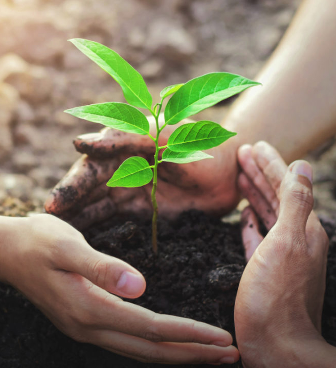
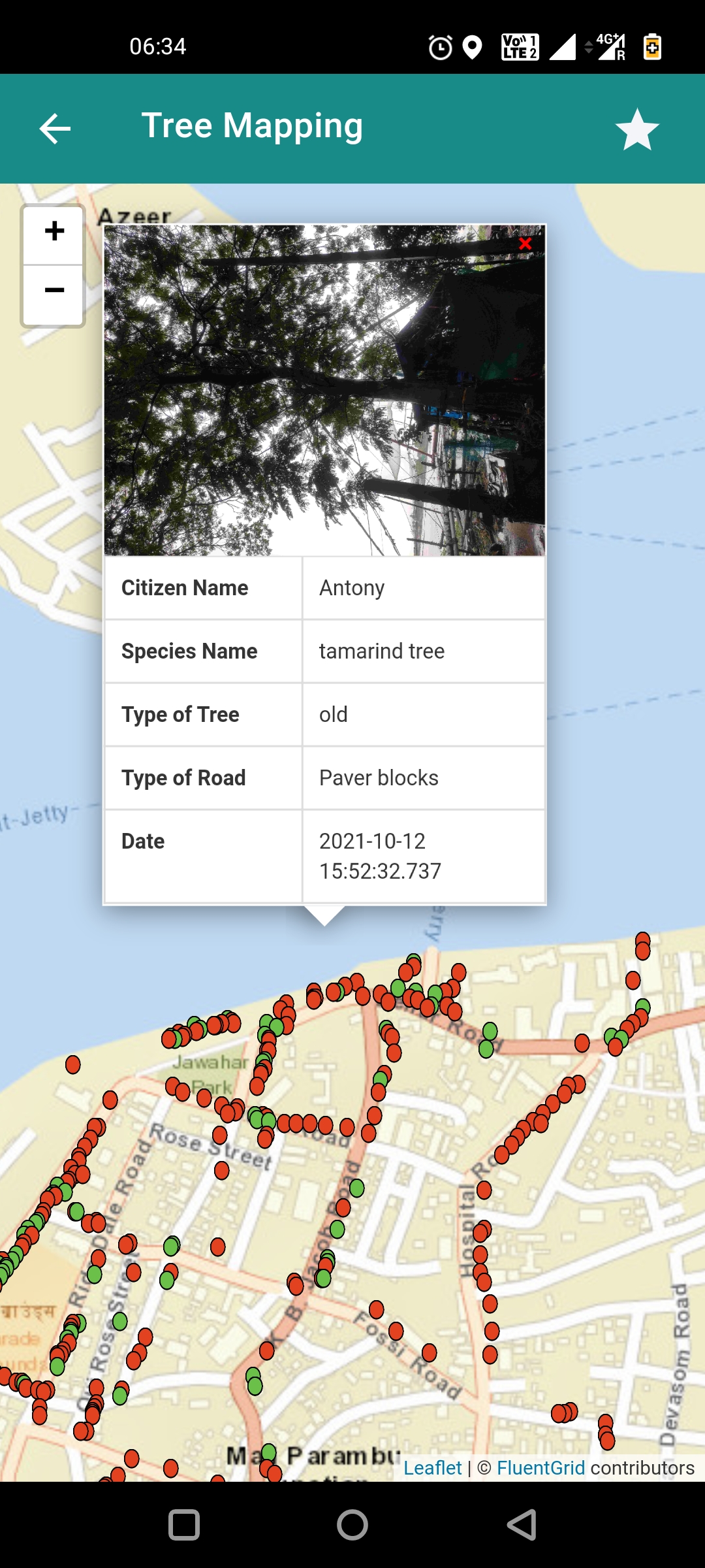
In the post-pandemic scenario, along with the rapid urbanisation we face in the cities, it is of utmost importance for us to preserve the native biodiversity. The average temperature rise and the increased GHG emissions need to be kept in check in our cities. The green cover and biodiversity in our urban spaces are visibly degrading leading to low carbon sinks and increasing microclimate. To develop and maintain better green spaces, evidence-based planning and data-driven decision making need to be incorporated. This has to be bolstered with citizen accountability and participation to ensure a better quality of life. A better synergy should exist between the stakeholders of the city which are mainly the citizens and the local bodies. Preserve is an interactive digital tool to help in creating resilient and greener cities by enabling planned green cover improvement and processes to maintain the green spaces around us through participation from assigned citizen volunteers and communities. The tool currently helps citizen volunteers and officials in geotagging avenue trees. The data collection happens in a simple form format to get the near accurate location and parameters such as the tree species, condition of the tree and road type. The output acts as a visual aid for the city planning authorities, tree/forest authorities and relevant decision-makers to plan green cover, public open spaces, non-motorised pathways and recreational amenities by bringing in the aspect of citizen science.


Through the application, the following is possible:
Seamless geotagging
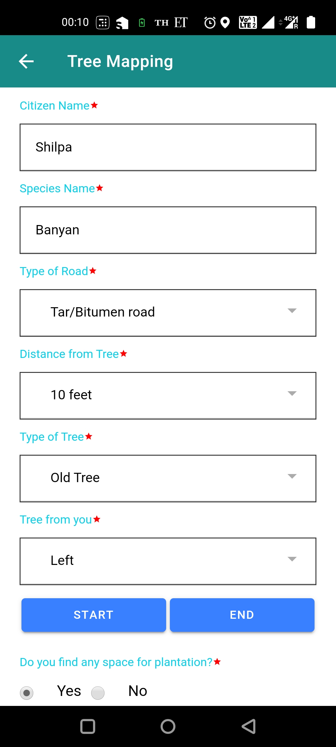
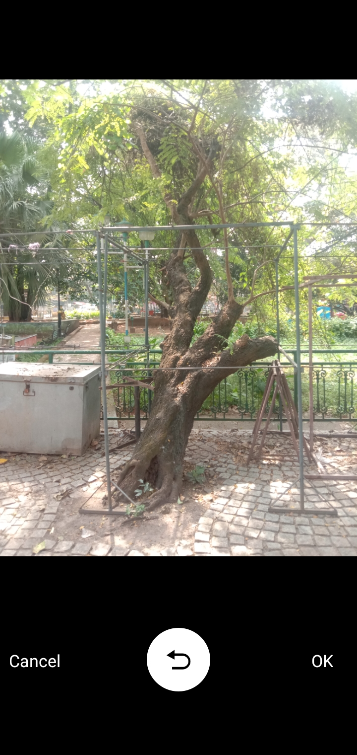
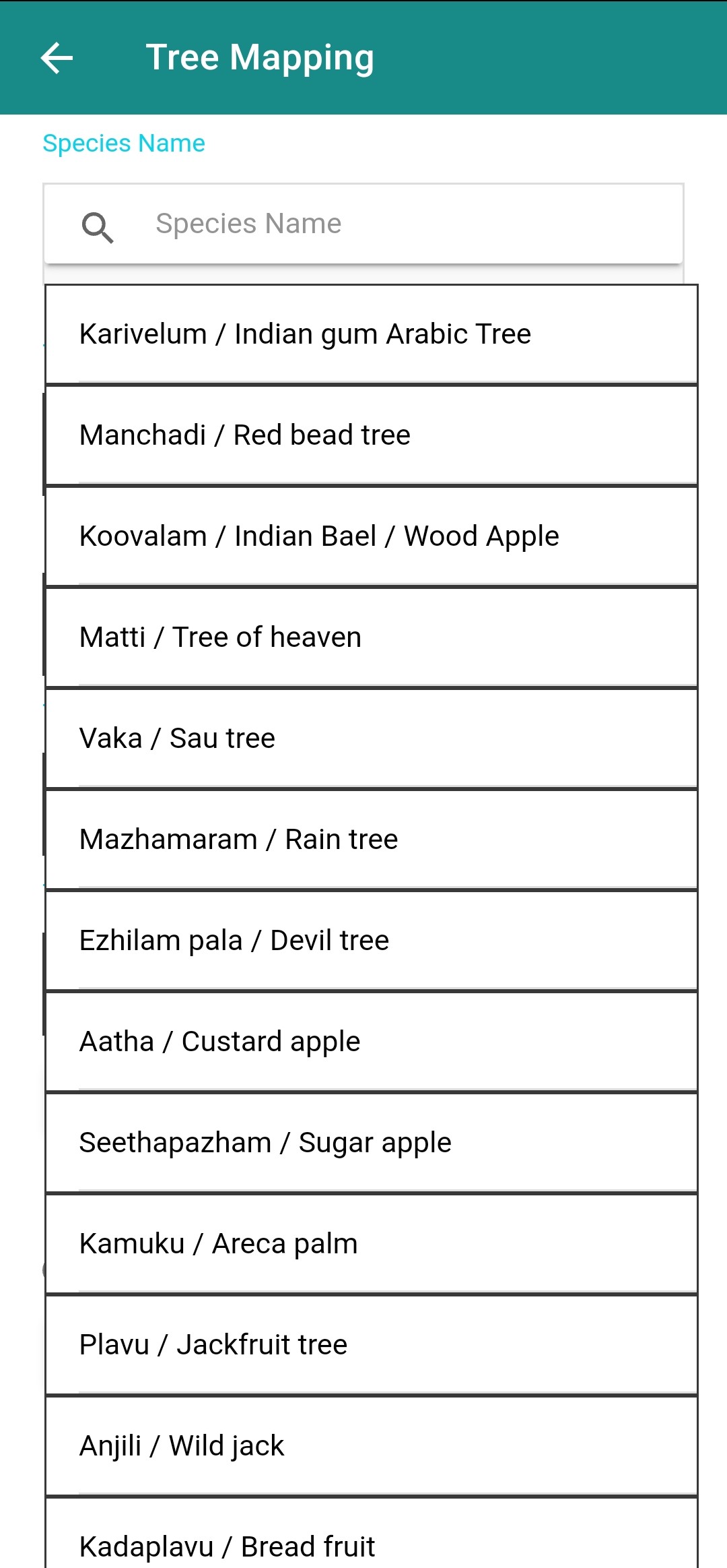
Citizen volunteers can geotag avenue trees by simply clicking an image of the avenue trees and providing the parameters
Crowdsourcing
Collect data on the avenue trees using citizen science
Tree census
Support to the ULB in conducting a non-technical exercise of tree census
Road
Planning
NMT routes by assessing the spatial data and the tree count in different areas of the city
Data integration
Integrating the output of the mapping into the city ICCC for decision making

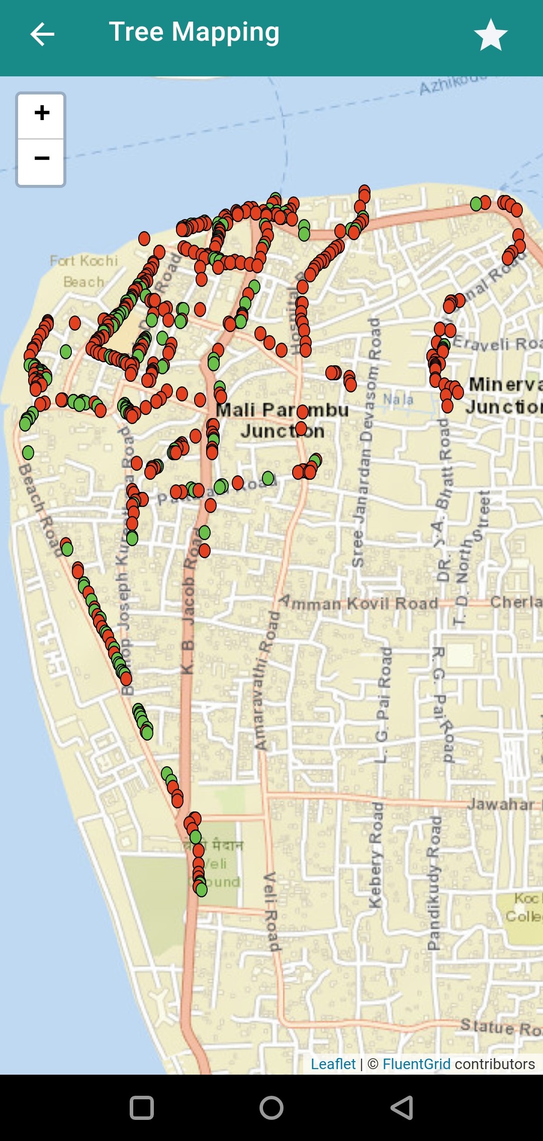
Kochi was chosen as the pilot city after several rounds of shortlisting among the 100 smart cities. The pilot area was chosen to be Fort Kochi and Mattancherry, considering the varying spread of green cover and the active citizen participation in that area.
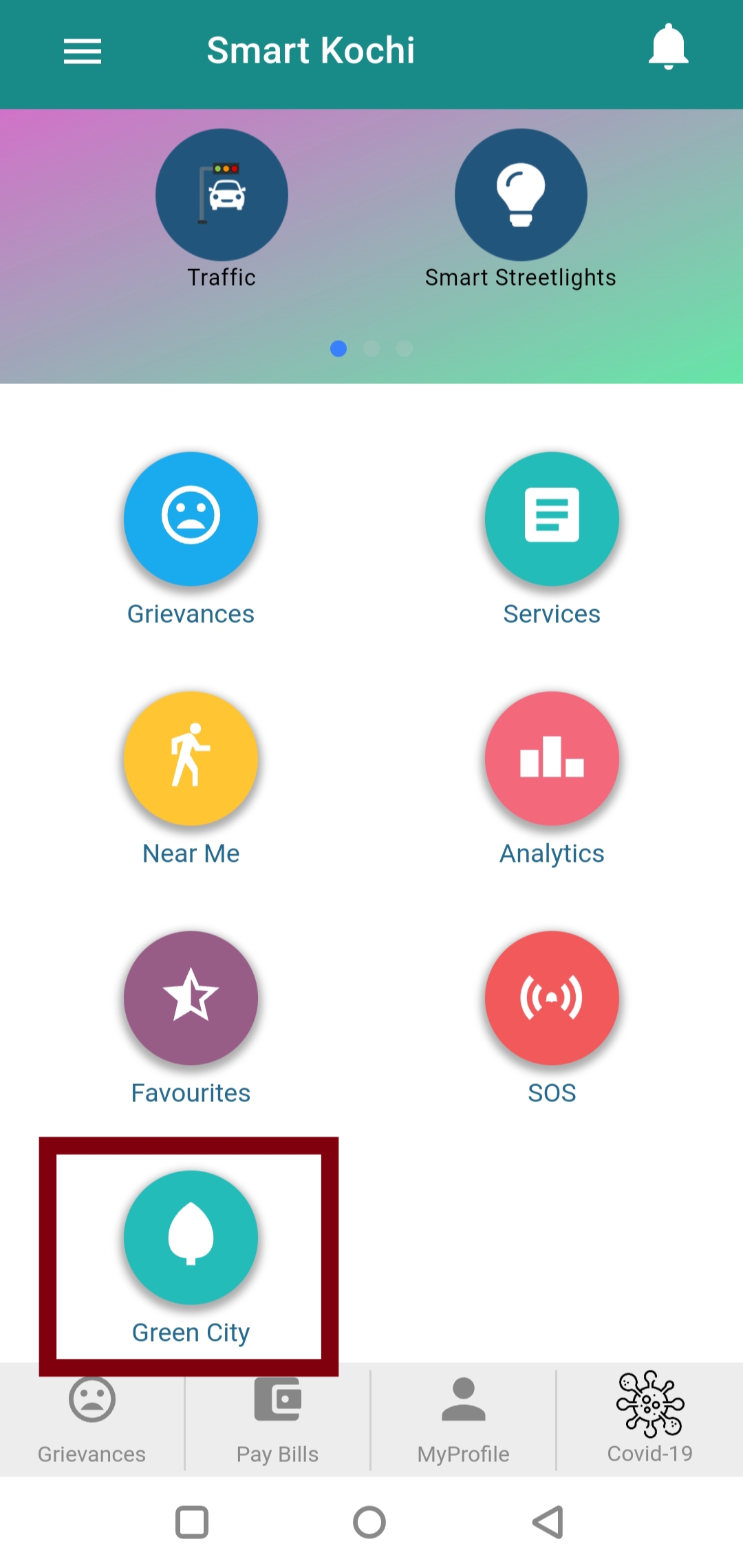
The tool was integrated into the smart city’s mobile application, “Smart Kochi”, as a ‘Green City’ feature. A citizen engagement pilot was conducted where the participants mapped around 200 trees in the Fort Kochi area and it is saved in the database of the Smart City.

Head - Climate Centre for Cities and Chair, Urban Resilience at National Institute of Urban Affairs (NIUA).
Executive Director, ICLEI - South Asia

Public Policy Professional

Urban Development and Management Professional
Computer Engineer and Public Policy Professional
Civil and Structural Engineer


Urbanization is picking up at a rapid pace, and intending to target a purely economy-centric and anthropocentric development, environmental concerns usually take a backseat. At present, cities are facing several environmental issues which influence the well-being and livelihood of millions worldwide. Urbanization and densification processes have led to a loss of urban green space and biodiversity within cities. With the increasing frequency and severity of environmental hazards and climate change such as heat, urban design strategies, and greening will play an important role in reducing vulnerability, promoting health, and building resilience. To fight this climate change, India has targeted to increase its green cover to 33% of the entire geographical area compared to the present 24%. Urban green spaces such as trees, gardens, and public open spaces, play a very critical role in cooling cities, and also provide safe routes for walking and cycling. These promote mental well-being, physical activity, social interaction and increased social recreation. After the pandemic, it has become very clear how important these are to the citizens. Team Preserve explored the possibilities to make sure that the responsibility and accountability of preserving the environment and its biodiversity doesn’t remain with the Urban Local Body alone, rather it should be a collaborative effort between the citizens and the city authorities. From the ambit of the environment, the team picked up avenue trees and green spaces as the focus areas to work on. After gaining a fair understanding of the various efforts that have happened in other countries and cities, we devised a strategy to move ahead with the idea of mapping trees and green spaces in the city with the help of citizen volunteers. The crowdsourced data would then be utilised by the city planning and environment authorities to take targeted actions.
The team consulted various experts working in the field of environment and biodiversity. An immense amount of research work was happening in this field but a heavy academically oriented product would not be relatable to common citizens who might be interested in helping out the ULB in crowdsourcing. Hence the idea of mapping accessible avenue trees and green spaces was finalised where the tree mapping would be the first phase. Consultation with experts from the smart city, ICLEI, WRI, INTACH and the forest department led to devising the strategy to gather information about the tree species, condition of the trees, road type and identifying the available space for plantation through this tool along with the geotagged trees. After an exhaustive city selection process, Kochi was selected as the pilot city for this project.
Upon discussion with the smart city team, it was agreed that the tool would be developed within the existing smart city application. The development support was provided by Fluentgrid Ltd., who had worked on the city’s ICCC and the mobile app. The pilot area was finalised to be done at Fort Kochi and Mattancherry. The tree mapping process was developed as geotagging trees by clicking the images of the trees and the coordinates would be assigned. Provisions were given to gather data on the concerning parameters for the mapped trees. Preserve team and the development team from the city conducted multiple site visits to Fort Kochi for testing and trial mapping. The data fed through the app while mapping would be sent to the AWS cloud storage existing with the ICCC.
After several rounds of testing, a final .apk file was released for the pilot with the citizens. For the pilot, a registration flyer was posted online and a webinar was conducted for interested citizens on the process of data collection using the tool. A detailed SOP along with a video was circulated to the registered citizen volunteers. The pilot was conducted with the help of around 40 volunteers and close to 200 trees were mapped in the Fort Kochi and Mattancherry area. The mapped trees were shown spatially on the Tree mapping section of the app (under the “Near me” option) along with their metadata.